Weiser River at Cambridge, ID
River level and flood forecast · Washington County
The river is 9.4 ft below flood stage (12 ft).
Forecast to hold near 2.6 ft through Mon, Oct 19, 6 PM.
Flow: 31 cubic feet per second (USGS).
River camera
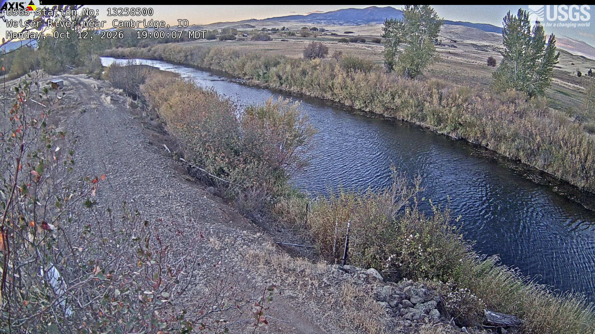
Watch the time-lapse
Camera by the U.S. Geological Survey. Most take a picture every hour, some every few minutes; many stop at night.
The last 7 days and the forecast
NWS forecast issued Mon, Oct 12, 1:07 PM. Forecasts change as rain falls and as upstream water arrives.
Get flood alerts for this river
An email when the National Weather Service forecasts Weiser River at Cambridge to flood, when it floods, and when it's over.
Flood stages
| Major flood stage | 14.5 ft |
| Moderate flood stage | 13 ft |
| Flood stage | 12 ft |
| Action stage | 11.5 ft |
| Record crest (December 22, 1964) | 15.9 ft |
What floods at each level
From the National Weather Service, highest first.
- 14 ftWater will impact the trailer court in Cambridge. Many county roads will be flooded and impassable. Water will flood homes near the river around Cambridge and Midvale not protected by levees.
- 13.5 ftWater will cover portions of Bain Road and Goodrich Road. Some homes near the river east of Cambridge will be surrounded by water and some outbuildings will be flooded. Water will approach the top of the levee protecting Mundo RV Park.
- 13 ftFlooding of fields and agricultural land near the river will occur from Mundo RV Park downstream through the Cambridge and Midvale areas. Water will cover portions of Old Highway Road in the canyon just south of Cambridge. Water will begin flooding feedlots near the river between the Mill Road bridge and the Highway 95 bridge east of Cambridge. Water will approach some homes between Selubia Bridge and the canyon just south of Cambridge. Debris may begin piling up at bridges.
- 12.5 ftFlooding of fields and agricultural land adjacent to the river can be expected around Cambridge and Midvale.
- 12 ftMinor flooding of low lying areas near the river can be expected downstream of Cambridge.
Highest crests on record
- 15.9 ft — December 22, 1964
- 14.54 ft — January 1, 1997
- 14.36 ft — February 25, 1958
- 14.05 ft — April 9, 2019
- 13.86 ft — January 29, 1967
Recent crests: 8.39 ft (March 17, 2025) · 7.64 ft (January 22, 2024) · 8.79 ft (May 2, 2023) · 6.56 ft (May 7, 2022) · 7.82 ft (March 19, 2021)
Up and down the river, and nearby
Not an official source. River levels, forecasts, flood stages and impacts are from the National Weather Service (CAMI1); flow from the U.S. Geological Survey. Readings are provisional. In a flood, follow your local officials and the NWS at weather.gov.