Trempealeau River at Arcadia, WI
River level and flood forecast · Trempealeau County
The river is 4.4 ft below flood stage (8 ft).
Flow: 405 cubic feet per second (USGS).
River camera
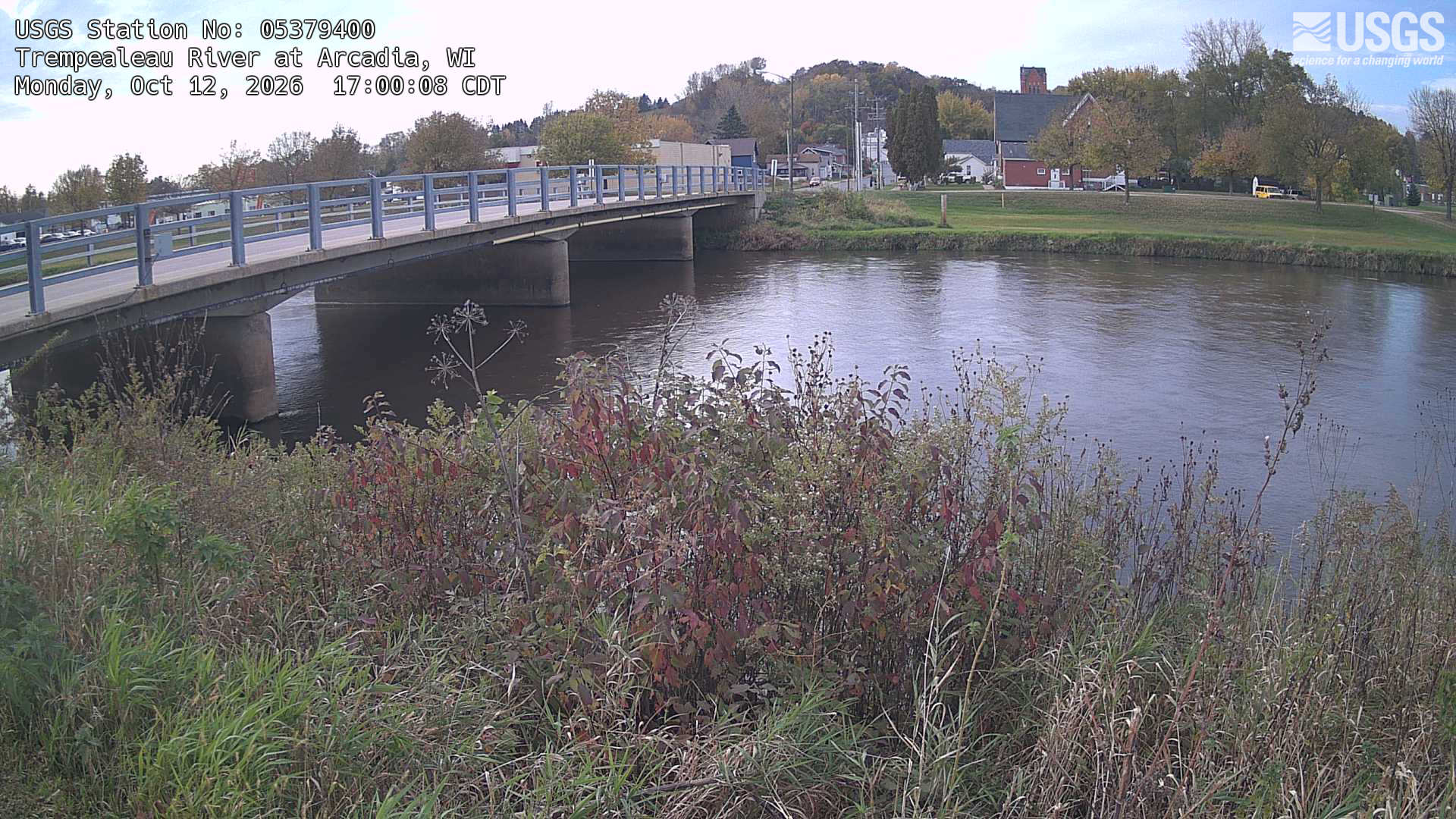
Watch the time-lapse
Camera by the U.S. Geological Survey. Most take a picture every hour, some every few minutes; many stop at night.
The last 7 days and the forecast
NWS forecast issued Wed, Sep 23, 6:07 AM. Forecasts change as rain falls and as upstream water arrives.
Get flood alerts for this river
An email when the National Weather Service forecasts Trempealeau River at Arcadia to flood, when it floods, and when it's over.
Flood stages
| Major flood stage | 10 ft |
| Moderate flood stage | 9 ft |
| Flood stage | 8 ft |
| Action stage | 6 ft |
| Record crest (September 24, 2010) | 10.07 ft |
What floods at each level
From the National Weather Service, highest first.
- 14.5 ftWater will overtop levee along Ashley Way between W River and Main Streets.
- 13.5 ftW River Street bridge is completely inundated with water.
- 12 ftWater reaches the bottom of the River Street Bridge. Water will overtop the levee along the Rudy Klink Deer Park.
- 11.5 ftWater begins to overflow the east end of the bridge near the Ashley Way and W River Street intersection.
- 10 ftWater flows over a part of the levee on the west bank and causes flooding along Willow St. Highest flood on record at 10.07' back in 2010.
- 9 ftHigh water begins to flood Ashley Way south of W Main Street near Ashley Furniture.
- 8 ftMinor flooding begins. A few streets are affected by high water, and pumping operations begin.
- 6.5 ftWater begins to overflow the western banks of the river near the canoe launch, between W River and Main Streets, and along the car dealership parking lot.
Highest crests on record
- 10.07 ft — September 24, 2010
- 9.61 ft — July 20, 2017
- 9.5 ft — May 18, 2017
- 9.2 ft — August 14, 2010
- 9.09 ft — August 12, 2016
Recent crests: 8.23 ft (August 18, 2025) · 8.18 ft (July 14, 2024) · 5.9 ft (August 27, 2021) · 7.71 ft (May 30, 2020) · 8.31 ft (September 13, 2019)
Up and down the river, and nearby
- DownstreamTrempealeau River at Dodge, WI
- Mississippi River below Lock and Dam 5a - Winona, MN
- Mississippi River at Winona - Pool 6, MN
- La Crosse River near La Crosse, WI
- Black River (WI) at Black River Falls, WI
- Root River (MN) at Houston, MN
- Root River (MN) above Rushford, MN
- South Fork Root River near Houston, MN
Not an official source. River levels, forecasts, flood stages and impacts are from the National Weather Service (ARCW3); flow from the U.S. Geological Survey. Readings are provisional. In a flood, follow your local officials and the NWS at weather.gov.